NYS Adirondacks
New York State Adirondacks: Transit Feasibility Study
Overview
- Description: New York State Department of Environmental Conservation (NYSDEC) worked with the Volpe Center to create a transit feasibility study for the High Peak Region in the Adirondacks area of New York.
- When: 2020-2021
- Status: Feasibility finished, pilot starting in 2022
- Technology Used: Crowdsourced data (Waze, AllTrails), Average Annual Daily Traffic (Flag - Where does AADT data fall?), Administrative Data
Resource Considerations
| Cost | Time |
|---|---|
 |  |
Role of Administrative Data
Trail registration is a commonly used data point to show general trends on trail usage over time. NYS DEC and partners collected and compiled trail registration data since the 2000's. This data strongly supported the assumption that trail usage is rising in the region, and planners should expect this trend to continue.
Role of Partner Data
NYSDOT provided a variety of datasets for segments the Route 73 corridor. These primarily included the Average Annual Daily Traffic (AADT) estimates and crash reports.
Role of Crowdsourced Data
Due to the COVID-19 pandemic, it was not possible to carry out a site visit to gather information on the area context and general transportation issues. As a workaround, the Volpe team analyzed multiple sources of crowdsourced data not typically used in these studies. The two types of crowdsourced data came from Waze (a navigation mobile app) and AllTrails (a hiking review platform).
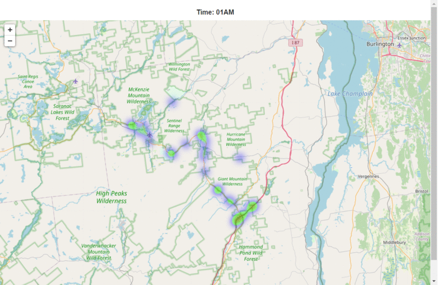
Waze Process & Findings
Waze is a mapping and directions application. The application is available for any smart phone user, and uses smart phone locations to direct users, primarily drivers, to a destination. Waze provides unique functionality to alert drivers on important road issues. These include traffic jams, road closures, road hazards, weather hazards, crashes, and speed traps. Waze collaborates with government agencies through the Waze Connected Citizens Program. Through this program, Waze works with U.S. Department of Transportation to share certain data useful for transportation planning and analysis. This data is available since 2017 and receives near-real-time updates to the internal USDOT Secure Data Commons (SDC).
For this project, Volpe and NYS DEC used Waze data to visualize where and when these traffic events happened since 2017. These data are shown in the gif below. The Volpe and NYS DEC teams used this data to look more deeply into hot spots to see where and when these are happening on the Route 73 corridor between I-87 in the Southeast and Lake Placid in the Northwest. These insights were compared with park ranger assumptions to confirm the hours and general locations of traffic jams on the corridor.
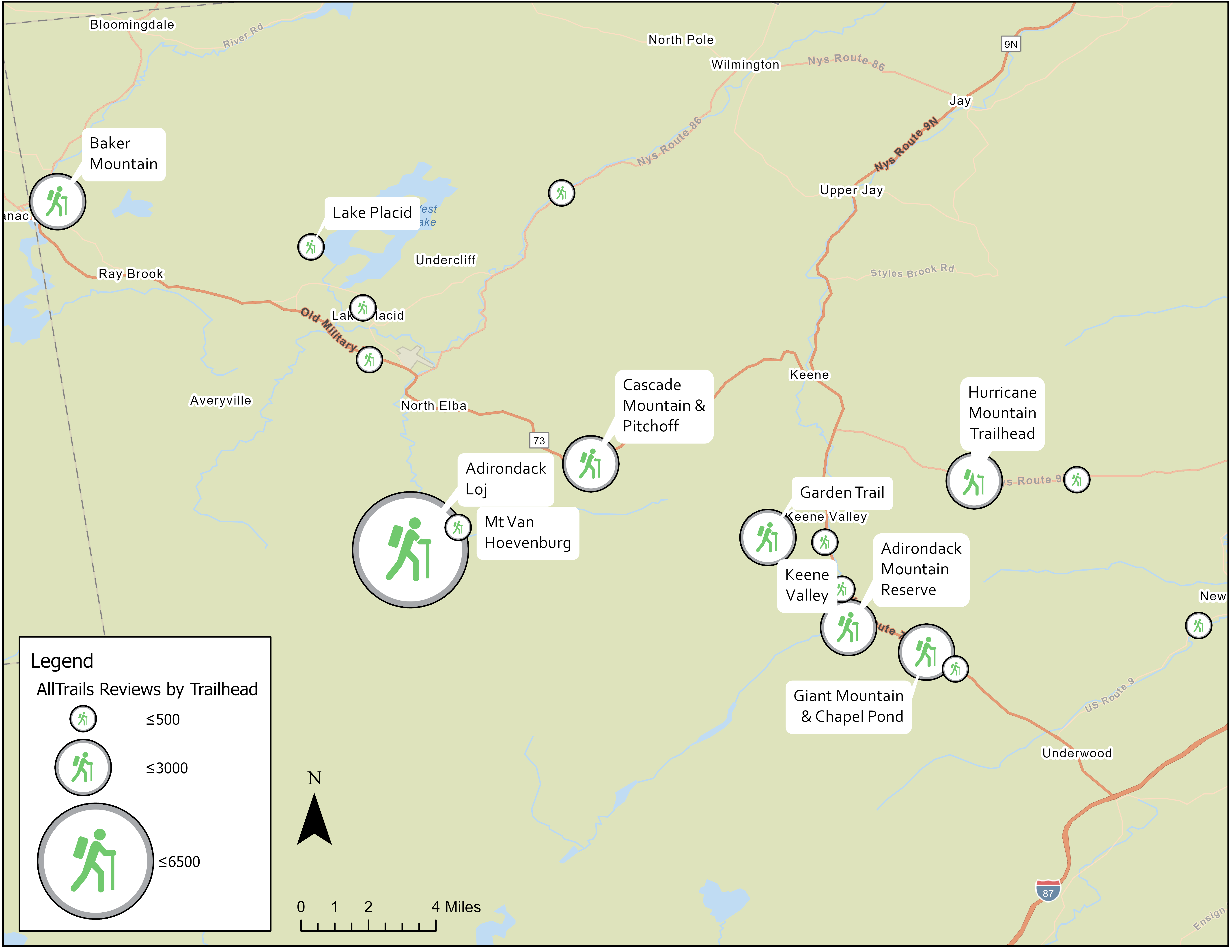
AllTrails Process & Findings
AllTrails is an online platform where users can add, rate and review trails, primarily for hiking and backpacking. AllTrails contains roughly 150 trails from the Adirondack region. Each of these trails has information about the level of difficulty, average number of stars rating, pictures, videos, and comments, among other fields.
AllTrails provided context to the hiker activity in the region. Specifically, this could be compared with park ranger assumptions to confirm the trailhead popularity and general time needed by visitors at each trailhead.